Guideline Geo
Ground Penetrating Radar

MALÅ is the world's premier provider of ground penetration radar (GPR) solutions, enabling professionals to create, analyze and transform vast amounts of complex data into easily understandable representations of the subsurface. With a history of high-tech innovation going back to the 1930s, MALÅ technology allows faster, safer decisions to be made while reducing project costs and protecting public safety. Mala(GuidelineGeo) Gadelius Industry K.K. has been the distributor in Japan since January 2024.
MALA Easy Locator Core
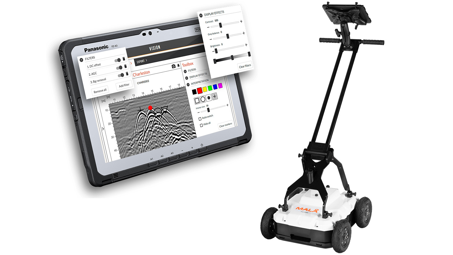
THE WORLD'S FIRST INTELLIGENT GROUND PENETRATION RADAR(GPR) SOLUTION
MALÅ Easy Locator Core is the state of the art, intelligent ground penetrating radar solution for utility locating professionals.
MALÅ Easy Locator Core includes the best data quality on the market, real-time interpretation support through MALÅ AI; wireless data collection using mobile devices; cloud storage, post-processing and on-site reporting using MALÅ Vision.
All with the fastest workflow on the market.
Feature
- optimized for locating and mapping utilities
- Swedish quality, unparalleled performance and a variety of revolutionary new features
- lighter and easier to use than anything else
- rugged and capable of Traversing the toughest terrain
- unsurpassed resolution, bandwidth, and data clarity
- real-time interpretation from MALÅ AI while collecting data
- access and share your data anywhere on any device
- cloud-connected to MALÅ Vision for instant processing in the field
- constantly updated with new unique features and improvements
- built with the pride and the passion of a company with a century as leaders in geophysics
- all with the fastest workflow on the market
| Specification | |
|---|---|
| Product name | MALÅ Easy Locator Core |
| Processing platform | MALÅ Vision |
| Artificial Intelligence | Real-time MALA AI |
| Core Technology | MALÅ HDR real-time sampling |
| Data output | 32 bit |
| Weight (in operation) | 15 kg |
| Antenna center frequency | 450MHz |
| Operating time | 8 h |
| Environmental | IP65 |
| Positioning | RTK GNSS(option), DGNSS, mobile device positioning, Encoder wheel, Total station support |
| Bandwidth | >121% , fractional, -10dB |
MALÅ MIRA COMPACT
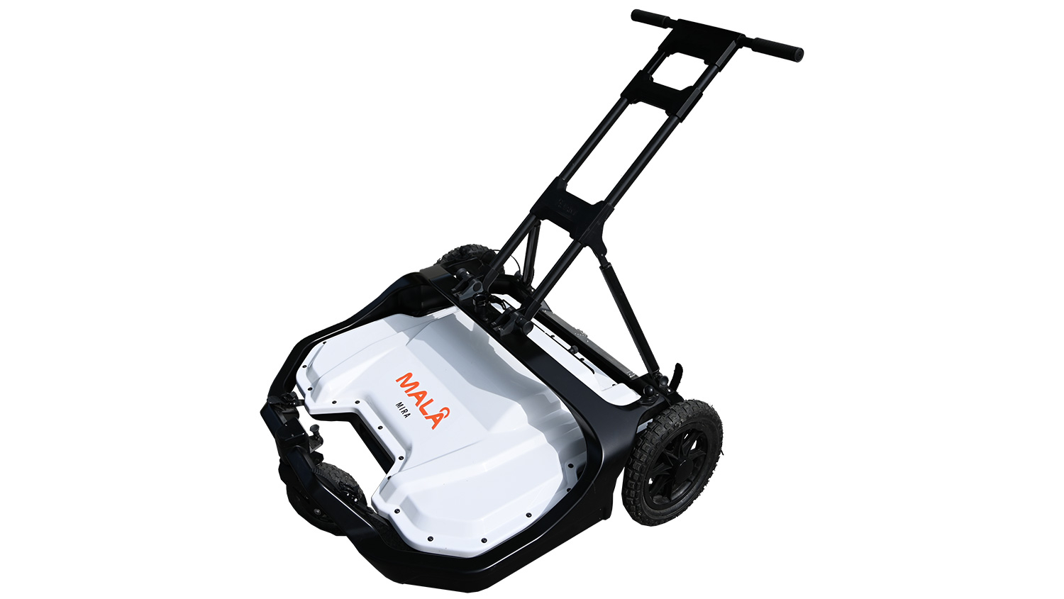
3D GPR mapping in a compact format
MIRA Compact includes our world-renowned MALÅ HDR real-time sampling technology providing ultra-fast measurements and razor-sharp data. The solution seamlessly integrates acquisition, processing, QA/QC, positioning and interpretation of ground penetrating radar data.
| Specification | |
|---|---|
| Product name | MALÅ MIRA COMPACT |
| Weight (in operation) | 42kg |
| Antenna center frequency | 500MHz |
| Maximum number of channels | 30 |
| Operating time | 8 h |
| Environmental | IP65 |
Other MALÅ products
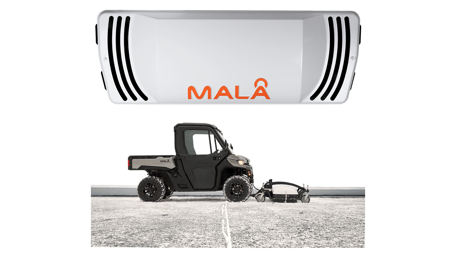
MALÅ MIRA HDR
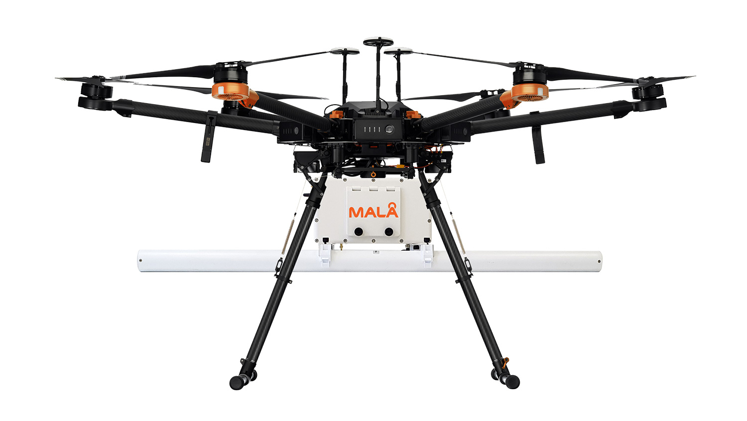
MALÅ GEODRONE 80
※Limited use
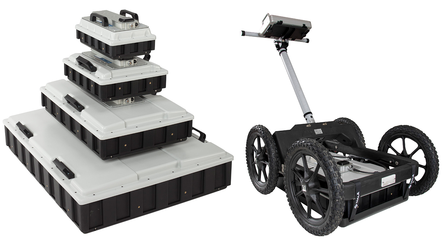
MALÅ GROUND EXPLORER GX
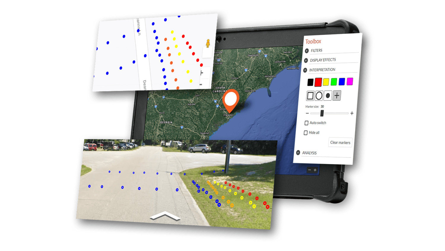
MALÅ VISION/SOFTWARE
About GuidelineGeo History
Today, Guideline Geo is a global leader in our field. We have customers in over 100 countries and a long history of developing solutions to geophysical and geotechnological challenges.
The historical roots that support Guideline Geo stretch back to the start of the 20th century, with the founding of Aktiebolaget Elektrisk Malmletning (ABEM), a producer of electrical equipment for ore prospecting, in 1923. Shortly afterwards, Sveriges Geologiska Undersökningar (SGU), the company that developed the first electromagnetic loop for ore and metal detection, established an office in Malå, in northern Sweden.
The success story grew from there. By the 1950s, ABEM was Europe's largest geophysical consulting company, while parts of SGU eventually evolved into MALÅ GeoScience AB with a proud heritage of technical development and innovation, eventually giving rise to today's pre-eminence in ground penetrating radar (GPR).
ABEM and MALÅ joined forces in the early 1990's and were incorporated into Guideline Technology AB between 2007-2011. The group was eventually consolidated under the name Guideline Geo in 2012 as the world's premier provider of technological solutions for mapping and visualizing the subsurface.
ABEM is a global pioneer of geophysical solutions for customers working with crucial resources and infrastructure development within resistivity, induced polarization, electromagnetics and seismics. ABEM solutions should be the first choice for use in evaluating soil conditions, detecting and mapping groundwater, mineral exploration and infrastructure site investigations.
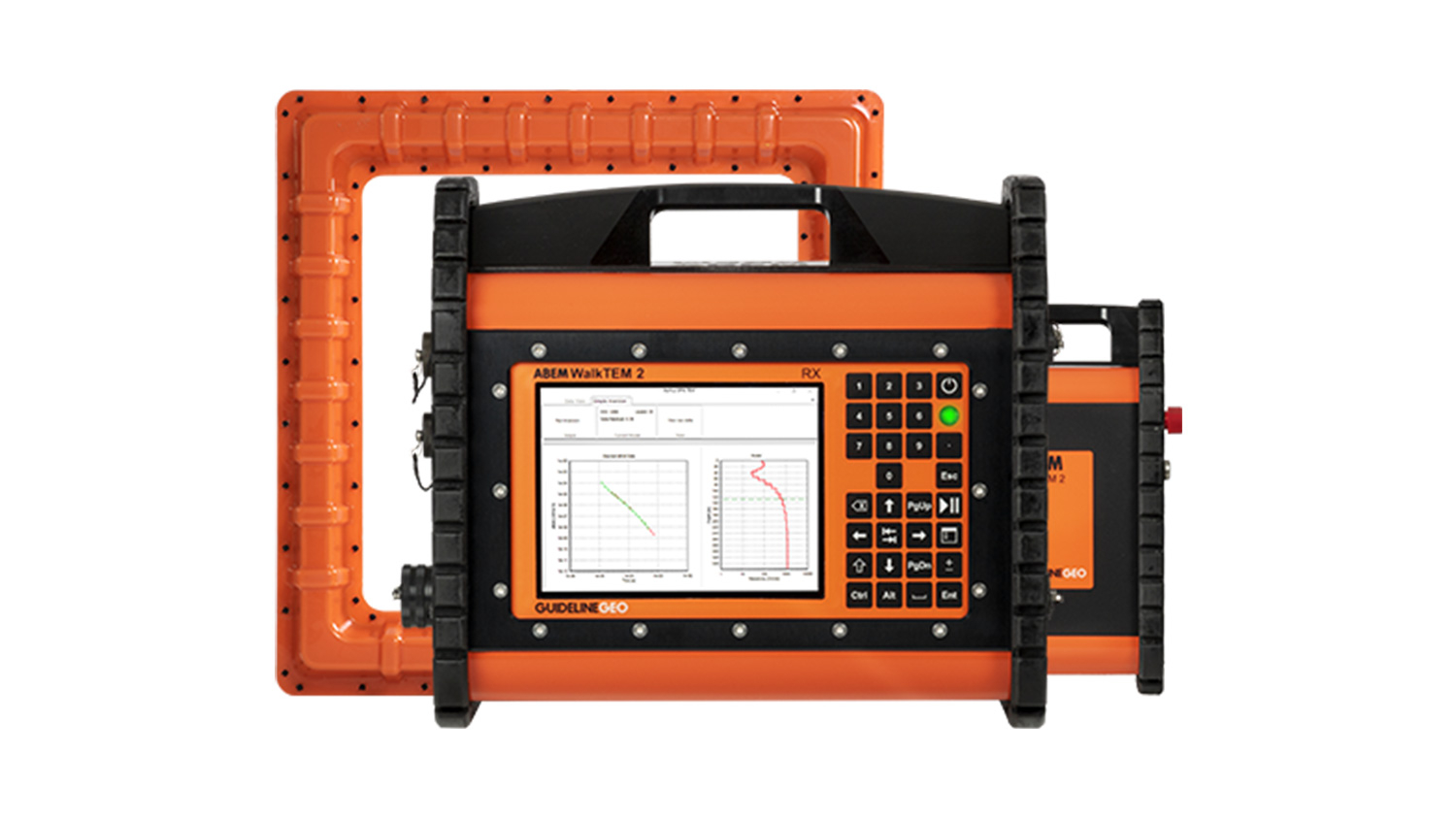
ABEM WALKTEM 2
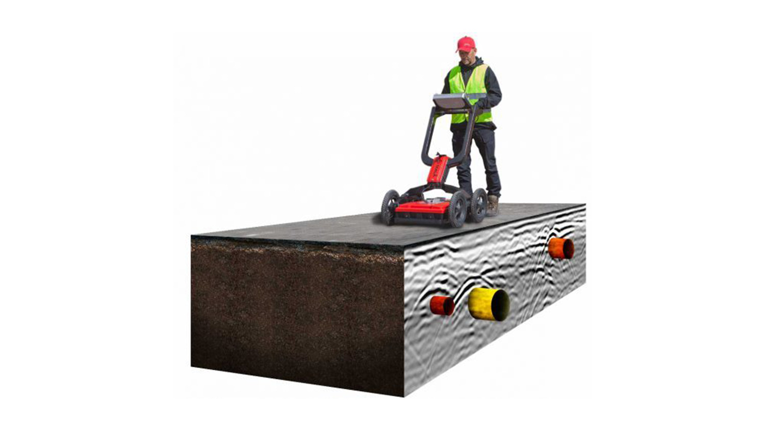
What is Utility Locating?
The ground beneath our feet in urban areas inevitably gets more and more congested over time with infrastructure comprising both underground structures and utilities. This, together with increasing urbanization and regeneration, aging infrastructure, climate change and flooding, are fueling a need for utility locating and better understanding of the subsurface conditions.
This is no easy task; utilities can, for example, consist of pipes, conduits, cables, tanks of differing material, size, and age. These utilities are buried at different depths in the ground which can be made up of widely varying natural and imported materials. The knowledge of both the location and depth can be lacking, due to obsolete, inaccurate, or non-existent subsurface maps. This lack of knowledge can lead to excavation or cutting in the wrong places, which in turn can cause serious damage, be dangerous, costly, and result in huge time delays.